|
Inicio / History /
Fourth Period |
PDF |
|
Fourth period - The big changes (2000 - Today)
|
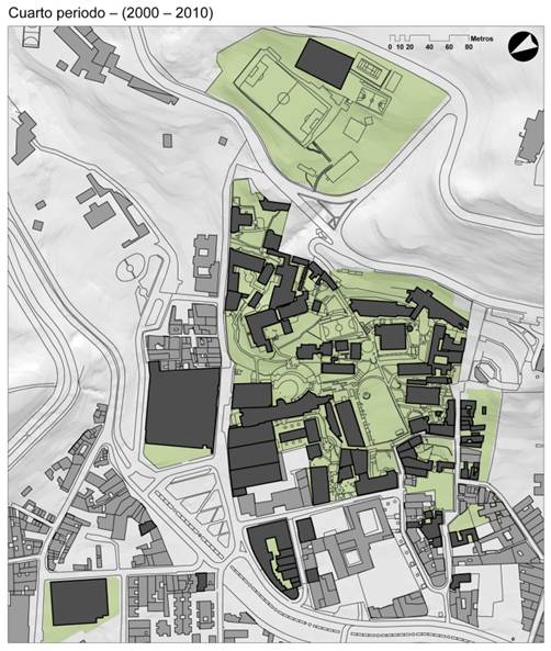
CAMPUS MAP - FOURTH PERIOD
|
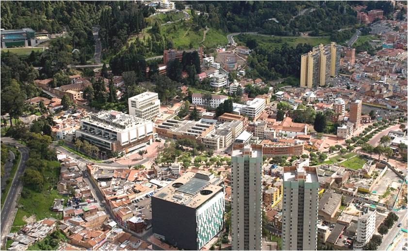
Aerial photography taken in 2009
|
|
|
|
The fourth and last period of the University´s physical development has been under the influence of Bogota´s land use master plan (POT according to its initials in Spanish); a plan that is used to organize the City and the community services land use. Additionally, based on its 2001-2005 Comprehensive Development Program (PDI according to its initials in Spanish), the University formulated the Regulation and Management Plan (PRM according to its initials in Spanish), the first of its kind that was approved by the district administration and the one that became its “road map” since 2003 (when it was approved) until today.
With these new guidelines, Los Andes sped up its Campus growing process and went from having 787.767 sq. ft. to 1.677.329 sq. ft. built; it managed to increase by 102% its built area. From these 889.561 new sq. ft. built, 81% (that is 724.088 sq. ft.) belongs to the halls (the Mario Laserna Hall [Block ML] and the Julio Mario Santo Domingo Hall [Block Sd]) that were built outside the central site, in some territories located next to it.
Based on the events that have been mentioned, Los Andes has so far managed to consolidate a Campus that totals 23.47 acres of gross floor area, 1.677.329 sq. ft. of built area and 80 halls.
|
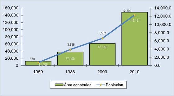
Built area vs population
|
Events
|
|
|
Lands: PRM, Partial Development Plan.
Building: new buildings, urban campus.
Spaces: centralized management; standardization.
|
|


